
Ancient India Map Activity (Indus Civilizations, Maurya & Gupta Empire)


- Zip
- Google Apps™

What educators are saying
Also included in
 This money saving bundle includes all of my Ancient India products. Click on each link to learn more about each Ancient India resource (these products are also available for purchase individually):Ancient India PowerPoint and Guided Notes {Harappa, Vedic Age, Mauryan & Gupta Empires} Ancient InPrice $30.60Original Price $38.25Save $7.65
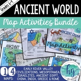 This bundle contains all of my print and digital map activities for the Ancient World. Each set has a contains different versions to help meet the needs of all of your students. The sets also include PowerPoints to help guide students through completing the map - a great tool if you are teaching witPrice $37.00Original Price $44.25Save $7.25
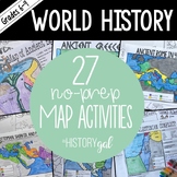 This bundle contains all of my map activities for World History and includes maps for ancient and modern World History. Print and digital versions are included with all map sets. I will add maps to this bundle as I create them. When new maps are added, the price will increase. Check out the previewsPrice $74.00Original Price $92.50Save $18.50
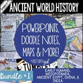 This bundle includes lots of great interactive activities that your students will love! For descriptions of each included item click the links below:Archaeological Dig: Using Modern Objects to Learn About ArchaeologyTelling Time in History Doodle Notes and Digital Guided Notes Early Humans and the SPrice $140.88Original Price $176.10Save $35.22
Description
Students will label and color a map to help them visualize and retain the location of the Indus Civilizations, Maurya Empire, and Gupta Empire as well as key geographical features such as the Brahmaputra, Ganges, and Indus Rivers; Eastern and Western Ghats; Himalayas; Hindu Kush, and more. Students will also use the map to answer 5 questions.
What's Included with the printed versions:
*Blank map with 5 questions for students to answer (2 pages, uneditable pdf)
*Blank map without questions (1 1/2 pages, uneditable pdf)
*Map for students to just color (1 page, uneditable pdf)
*Answer key for map and questions (2 pages, uneditable pdf)
*Animated PowerPoint shows each location and the key - perfect for classrooms without textbooks or Internet access (10 slides, each slide guides students through completing the map, some text is editable but images are not)
What's included with the Digital Versions (added August 2020):
*Ancient India map for students to label (students will drag labels to the correct spot on the map; PowerPoint & Google Slides versions; not editable; with and without questions)
*Online Map lets students test their knowledge of locations in Ancient India (internet connection is required to access, works on all browsers and with all devices, no account and no logins required, self-checking)
This download contains files that may be printed and copied or used digitally. Use whichever version fit best with your class. The other version remain yours in case you ever need to use them (in case your school makes the jump to 1:1 classes sometime in the future or if you have a student whose IEP requires a hard copy of assignments instead of digital ones).
You may put the materials in this file on a LMS for STUDENT USE that RESTRICTS access like Google Drive, Google Classroom, OneDrive, Edmodo, Canvas, etc. where students are either invited via an email address or log in with a user name and password. IT MAY NOT BE UPLOADED TO A CLASS WEBSITE UNLESS THE SITE IS RESTRICTED TO STUDENTS WITH A LOGIN AND PASSWORD AND IT MAY NOT BE USED IN A COURSE ON OUTSCHOOL OR ANY SIMILAR PLATFORMS/MARKETPLACES.
Questions? Email me at andrea@musingsofahistorygal.com.
*This zip file contains PDF and PowerPoint files and PDFs with links to Google Slides and Form*
***This resource is included in the following larger bundles:***
*********************************************************************
You May Also Like:
Early River Valley Civilizations Bingo{Mesopotamia, Egypt, China, India}
More Historical Map Activities
More Resources for Teaching the Ancient World
*********************************************************************
Customer Tips:
Be the first to know about my new discounts, freebies and product launches:
• Look for the green star next to my store logo and click it to become a follower. Voila! You will now receive email updates about this store.
I value your feedback greatly as it helps me determine which products are most valuable for your classroom so I can create more of them for you. If you have any concerns or if any of my resources are not what you expected, please contact me first before leaving feedback so I can have a chance to fix it for you! You can email me at andrea@musingsofahistorygal.com.
How to get TPT credit to use on future purchases:
• Please go to your My Purchases page (you may need to login). Beside each purchase you'll see a Provide Feedback button. Simply click it and you will be taken to a page where you can give a quick rating and leave a short comment for the product. Each time you give feedback, TPT gives you feedback credits that you use to lower the cost of your future purchases.
Like this product?
• Click on the Pin it button and pin it to one of your boards!
*********************************************************************
Connect with Me
Click HERE if you'd like to get freebies from me sent to your inbox
