NOTES BUNDLE - Topographic Maps *EDITABLE* w/ PowerPoint
NYS Earth Science and Living Environment Regents
1.6k Followers
Grade Levels
8th - 12th, Homeschool
Subjects
Resource Type
Formats Included
- Zip
Pages
161 pages
NYS Earth Science and Living Environment Regents
1.6k Followers
What educators are saying
My students are in the 9th grade and need assistance with reading comprehension, regents questions and reviewing concepts. These guided notes help with them understanding the information for the ES regents. Great for the Topography concepts.
Great resource and really what you need to get started teaching topographic maps. Well thought out set of materials that are ready to use when downloaded.
Description
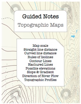
This Topographic Maps EDITABLE NOTES BUNDLE for Earth Science Regents classes includes:
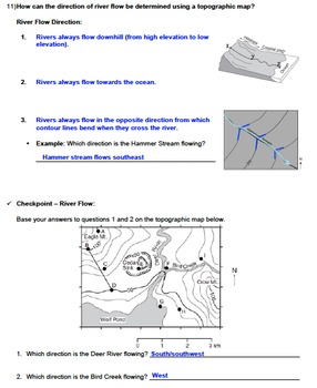
- 24 page guided notes with essential questions, visual aids, and checkpoint questions for students. (Word & PDF)
- 24 page answer key for teachers (Word & PDF)
- 113 slide PowerPoint Presentation with custom animations, links to web animations, and color-coded notes (students copy the blue!).
I find this especially helpful for my special education and ELL students!
Topics Addressed:
Map scale,
Straight line distance,
Curved line distance,
Rules of Isolines,
Contour Lines,
Hachured Lines,
Possible elevations,
Slope and Gradient,
Direction of River Flow,
Topographic Profiles,
Earth Science Reference Tables.
________________
*ENTIRE YEAR OF EARTH SCIENCE NOTES* - Huge Savings!
________________
MY TOPOGRAPHIC MAP RESOURCES:
EDITABLE WORKSHEETS:
Topographic Maps Worksheets - EDITABLE BUNDLE
Introduction to Maps
Drawing Isolines
Contour Interval
Possible Elevations
Hachured Lines
River Flow Direction *FREEBIE*
Slope and Gradient
Topographic Profiles
Topographic Maps
Topographic Maps Practice
UNIT NOTES:
Topographic Maps Unit Notes - EDITABLE BUNDLE with PowerPoint
LABS:
LAB - Analyzing a Topographic Map with PowerPoint
LAB - Nightmare Land Contour Map
LAB - Nightmare Land Contour Map PowerPoint
LAB - Profile of Mount St. Helens with PowerPoint
TASK CARDS:
TASK CARDS - Topographic Maps
________________
My Other Earth Science Notes Bundles:
Introduction to Earth Science
Prologue
Mapping:
Earth Dimensions and Navigation
Astronomy:
Celestial Observations
Earth in Space
Earth's Moon
Orbits
Our Solar System
Deep Space
Atmospheric Studies:
Atmospheric Energy
Water Cycle & Groundwater
Climate
Weather Factors
Meteorology
Geology:
Rocks and Minerals
Surface Processes
Landscape Regions
Plate Tectonics
Geologic Hazards
Geologic History
*************PREVIEW MY NOTES***************
FREE NOTES BUNDLE: Landscape Regions
Note to Customer:
Click on the ★ above to follow my store.
Leave feedback to earn credit points to save money on future products!
This download is for one personal classroom use only. Duplication or sharing with other classrooms, co-workers, an entire school system, or posting on any website or blog violates copyright law. If your school, grade level, or department wishes to use this product, please purchase an additional license for each teacher at the discounted additional license price when you checkout. Thank you!
Total Pages
161 pages
Answer Key
Included
Teaching Duration
2 Weeks
Report this resource to TPT
Reported resources will be reviewed by our team. Report this resource to let us know if this resource violates TPT’s content guidelines.


