
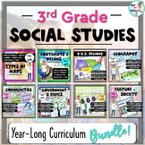
Types of Maps UNIT: Reading Passages, Activities, PowerPoint, & Test!


- Zip
Also included in
 This 3rd Grade Year-Long Bundle provides a complete social studies curriculum with a focus on literacy development, reading comprehension, and active learning. Student workbooks include informational reading passages, meaning no textbook is needed! In addition, student workbooks and PowerPoints arePrice $75.95Original Price $94.69Save $18.74
 This bundle features two print-and-go teacher favorites used in tandem- a Continents & Oceans, Map Skills unit and a Types of Maps unit! These units will enhance your students' map-reading skills, map fluency, and knowledge about the Continents & Oceans. The student workbooks and PowerPoinPrice $14.50Original Price $16.75Save $2.25
 The Social Studies, Year-Long Bundle provides a complete curriculum for upper-elementary classrooms with a focus on literacy development, reading comprehension, and active learning. 21st Century skills are emphasized with annotation and reading skills development, interactive hands-on activities, rPrice $84.95Original Price $115.65Save $30.70
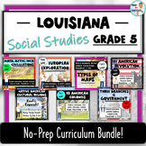 This bundle was customized for a Louisiana teacher by using resources that I have available. It is aligned with current state-standards, and will be adjusted when/if state standards change in the future. Check out the "Bonus File" to get a glimpse of how this bundle addresses Louisiana's Grade 5 SPrice $49.95Original Price $60.45Save $10.50
 This bundle was customized for a New York teacher by using resources that I have available. It addresses many state-standards. Check out the "Bonus File" to get more details about the New York Grade 5 Social Studies standards that the units in this bundle address. This is a No-Prep and No-TextbookPrice $47.95Original Price $61.72Save $13.77
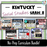 This bundle was customized for a Kentucky teacher by using resources that I have available. It is aligned with most state-standards, and focuses on early-American history. Check out the "Bonus File" to get a glimpse of how this bundle addresses Kentucky's Grade 5 Social Studies standards. Once purchPrice $63.99Original Price $86.95Save $22.96
Description
No-prep, 2-3 week unit on six different types of maps, and more! The map types included are: Political, Physical, Road, Climate, Resource, and Thematic. There is also a 3-page lesson on map reading skills and components, like a Map Title, Map Key, Scale, and Compass Rose. This unit includes complete lesson plans, a student workbook with informational text and reading comprehension tasks, an accompanying interactive notebook (activity lapbook), a PowerPoint for teacher-guided instruction, and an end-of-unit assessment.
The student workbook and PowerPoint presentation are Google 1:1 compatible. Reading and literacy skill building activities are built-in to the student workbook and encouraged throughout the unit. This unit is easy to use with whole-class instruction, independent learners, or as stations. (You can also buy the Student Workbook as a stand-alone resource by CLICKING HERE).
This "Types of Maps" unit is an excellent supplement to my CONTINENTS, OCEANS, & MAP SKILLS UNIT; check it out! (OR... bundle them together and save $$. CLICK HERE FOR MORE INFO!).
INCLUDED:
- A Student Workbook
- Vocabulary List
- Seven Lessons: Map Basics, Political Maps, Physical Maps, Road Maps, Climate Maps, Resource Maps, and Thematic Maps.
- Reading Passages with built-in Map Skills questions.
- Reading Skills activities
- Study Guide
- Google 1:1 Compatible
- An Activity Lapbook
- Completely aligned to the Student Workbook
- 3 interactive activities
- Can be used by students independently
- 8 Writing Prompts on a Choice Board
- Vocabulary Flashcards
- PowerPoint
- Provides a digital form of the Student Workbook
- Great for teacher-directed read alouds and whole-class instruction
- Unit content is not editable, but you can add or delete slides
- Google Slides presentation also included
- Teacher Guide
- Lesson plans with Student Learning Objectives and Essential Questions
- Answer Keys for all resources
- Unit preparation checklist
- State Standards: Common Core, TEKS, VA SOL
- Test
- Editable Word document
- 5 fill-in-the-blank questions with a word bank
- 5 multiple choice questions
- 2 short response questions
Check out these other Unit Bundles:
MESOAMERICA: MAYA, AZTEC, and INCA CIVILIZATIONS
DECLARATION, CONSTITUTION, & BILL OF RIGHTS Mini Books Bundle
Like this activity? "Tony the Tourist" is part of a growing series that offers a fun and interactive way to teach social studies to upper elementary and middle school students. FOLLOW ME, and you will be the first to know about new resources, freebies, and where Tony is going next!
Reviews are helpful! Go to "My Purchases" in your account, find this resource, and select the option to leave feedback. In return, you will receive "TpT Bucks" to use towards future purchases... it's a win-win!
