27 results
Geography thematic unit plans on sale
Mapping Skills with Google Earth: How to Read a Map Gr. PK-2
This is the chapter slice "How to Read a Map" from the full lesson plan "Mapping Skills with Google Earth"About the FULL RESOURCE:Teach your students the basics of map reading with our engaging resource designed for students in grades prekindergarten to two. Start with the elements found on a map, such as symbols, legends and the compass rose. Then, have your students apply what they’ve learned by mapping their classroom and route to school. Move on to the Great Lakes of North America and the se
Subjects:
Grades:
PreK - 2nd
Mapping Skills with Google Earth: Latitude, Longitude and Time Zones Gr. 3-5
This is the chapter slice "Latitude, Longitude and Time Zones" from the full lesson plan "Mapping Skills with Google Earth"About the FULL RESOURCE:Students will learn in-depth how to read and create maps with our engaging resource designed for students in grades three to five. Students will expand their knowledge of the elements on a map by exploring the lines of latitude, longitude and time zones. Then, students will learn about geographical and cultural features by exploring topographic and ch
Subjects:
Grades:
3rd - 5th
Mapping Skills with Google Earth: Map Elements Gr. 6-8
This is the chapter slice "Map Elements" from the full lesson plan "Mapping Skills with Google Earth"About the FULL RESOURCE:Move on from a basic understanding of map reading to a more complex one with our engaging resource designed for students in grades six to eight. Students will further develop their ability to read and understand maps by looking at weather and population maps. Then, students will engage in mapping their country in detail, including states, provinces, capitals, cultural and
Subjects:
Grades:
6th - 8th
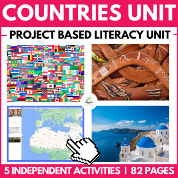
Country Research Project | Report Writing Unit | Geography & English Tasks
Your students can complete this excellent PROJECT-BASED LEARNING activity on CULTURES and COUNTRIES AROUND THE WORLD at home or school, drawing upon a deep pool of RESEARCH and NONFICTION writing skills as they peel back the layers of a COUNTRY of their choice.This completely EDITABLE collection of resources will walk your student through five engaging activities about a COUNTRY OF THEIR CHOICE to master research and information writing skills alongside highly creative and fun literacy tasks.NO
Subjects:
Grades:
3rd - 6th
Mapping Skills with Google Earth: Basics of Map Reading Gr. 3-5
**This is the chapter slice "Basics of Map Reading" from the full lesson plan "Mapping Skills with Google Earth"** About the FULL RESOURCE:Students will learn in-depth how to read and create maps with our engaging resource designed for students in grades three to five. Students will expand their knowledge of the elements on a map by exploring the lines of latitude, longitude and time zones. Then, students will learn about geographical and cultural features by exploring topographic and choropleth
Subjects:
Grades:
3rd - 5th
Mapping Skills with Google Earth: Map Your Classroom Gr. PK-2
This is the chapter slice "Map Your Classroom" from the full lesson plan "Mapping Skills with Google Earth"About the FULL RESOURCE:Teach your students the basics of map reading with our engaging resource designed for students in grades prekindergarten to two. Start with the elements found on a map, such as symbols, legends and the compass rose. Then, have your students apply what they’ve learned by mapping their classroom and route to school. Move on to the Great Lakes of North America and the s
Subjects:
Grades:
PreK - 2nd
Mapping Skills with Google Earth: Map Your Community Gr. PK-2
This is the chapter slice "Map Your Community" from the full lesson plan "Mapping Skills with Google Earth"About the FULL RESOURCE:Teach your students the basics of map reading with our engaging resource designed for students in grades prekindergarten to two. Start with the elements found on a map, such as symbols, legends and the compass rose. Then, have your students apply what they’ve learned by mapping their classroom and route to school. Move on to the Great Lakes of North America and the s
Subjects:
Grades:
PreK - 2nd
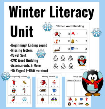
Winter Literacy activities: writing, phonics, Holiday Christmas morning work
Winter, Christmas and Holiday themed literacy, CVC, phonics and writing activities and worksheets. Perfect addition to any winter literacy unit- use as a center activity, morning work or independent work. Print out as no-prep worksheets, or put them in a page protector and use them again and again as a center activity! 45 pages (plus B&W version).Literacy Bundle includes:CVC word buildingBeginning sound identificationEnding sound identification Missing lettersVowel sortWinter word journal (
Grades:
K - 2nd
Mapping Skills with Google Earth: Map Your Continent Gr. PK-2
**This is the chapter slice "Map Your Continent" from the full lesson plan "Mapping Skills with Google Earth"** About the FULL RESOURCE:Teach your students the basics of map reading with our engaging resource designed for students in grades prekindergarten to two. Start with the elements found on a map, such as symbols, legends and the compass rose. Then, have your students apply what they’ve learned by mapping their classroom and route to school. Move on to the Great Lakes of North America and
Subjects:
Grades:
PreK - 2nd
Australia: Human and Environmental Interactions Gr. 5-8
**This is the chapter slice "Human and Environmental Interactions" from the full lesson plan "Australia"** About the FULL RESOURCE:Take your students on a journey through Australia, its countries, regions and cities by roadways and waterways. Understand its location relative to the rest of the world. Learn the interesting physical characteristics, wildlife, vegetation, population, and climates of the regions. Discover which human and environmental interactions are being made in Australia that im
Grades:
5th - 8th
Mapping Skills with Google Earth: Map Your Route to School Gr. PK-2
**This is the chapter slice "Map Your Route to School" from the full lesson plan "Mapping Skills with Google Earth"** About the FULL RESOURCE:Teach your students the basics of map reading with our engaging resource designed for students in grades prekindergarten to two. Start with the elements found on a map, such as symbols, legends and the compass rose. Then, have your students apply what they’ve learned by mapping their classroom and route to school. Move on to the Great Lakes of North Americ
Subjects:
Grades:
PreK - 2nd
Mapping Skills with Google Earth: Population Maps Gr. 6-8
**This is the chapter slice "Population Maps" from the full lesson plan "Mapping Skills with Google Earth"** About the FULL RESOURCE:Move on from a basic understanding of map reading to a more complex one with our engaging resource designed for students in grades six to eight. Students will further develop their ability to read and understand maps by looking at weather and population maps. Then, students will engage in mapping their country in detail, including states, provinces, capitals, cultu
Subjects:
Grades:
6th - 8th
Mapping Skills with Google Earth: Weather Maps Gr. 6-8
This is the chapter slice "Weather Maps" from the full lesson plan "Mapping Skills with Google Earth"About the FULL RESOURCE:Move on from a basic understanding of map reading to a more complex one with our engaging resource designed for students in grades six to eight. Students will further develop their ability to read and understand maps by looking at weather and population maps. Then, students will engage in mapping their country in detail, including states, provinces, capitals, cultural and
Subjects:
Grades:
6th - 8th
Mapping Skills with Google Earth: Map the World Gr. 6-8
**This is the chapter slice "Map the World" from the full lesson plan "Mapping Skills with Google Earth"** About the FULL RESOURCE:Move on from a basic understanding of map reading to a more complex one with our engaging resource designed for students in grades six to eight. Students will further develop their ability to read and understand maps by looking at weather and population maps. Then, students will engage in mapping their country in detail, including states, provinces, capitals, cultura
Subjects:
Grades:
6th - 8th
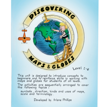
DISCOVERING MAPS & GLOBES Gr. 2-6
Introduce the salient concepts to beginners that reinforce skills in working with maps and globes. Designed for students with differentiated learning levels; including children who have had no experience in formal map & globe skills often experience difficulties when faced with geography as a subject at an intermediate level. The material in this package may be of benefit to children in junior and early intermediate grades as well. The activities are designed with participation in mind encou
Grades:
2nd - 6th
Types:
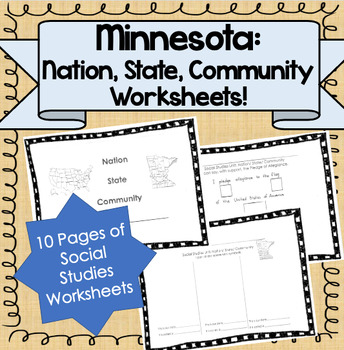
Nation, State, Community Unit! (Minnesota Specific!)
Product Information: This is a printable packet of 8 lessons for the unit Nation, State, Community. For use in primary classes!Lessons Cover:-Matching Pictures of Nation/State/Community (MN Specific)-MN State Symbols (draw and write)-USA State Symbols (draw and write)-Pledge of Allegiance (cut out symbols)-Our USA Flag (answer blanks)-Holidays I celebrate (cut outs and blanks)-National Holidays (cut outs and blanks)-Important People in the USA (draw and write)**NOTE: This is Minnesota specific
Subjects:
Grades:
K - 3rd
Mapping Skills with Google Earth: Map the World Gr. PK-2
**This is the chapter slice "Map the World" from the full lesson plan "Mapping Skills with Google Earth"** About the FULL RESOURCE:Teach your students the basics of map reading with our engaging resource designed for students in grades prekindergarten to two. Start with the elements found on a map, such as symbols, legends and the compass rose. Then, have your students apply what they’ve learned by mapping their classroom and route to school. Move on to the Great Lakes of North America and the s
Subjects:
Grades:
PreK - 2nd
Australia: Place Gr. 5-8
**This is the chapter slice "Place" from the full lesson plan "Australia"** About the FULL RESOURCE:Take your students on a journey through Australia, its countries, regions and cities by roadways and waterways. Understand its location relative to the rest of the world. Learn the interesting physical characteristics, wildlife, vegetation, population, and climates of the regions. Discover which human and environmental interactions are being made in Australia that impact world wide. Students will
Grades:
5th - 8th
Mapping Skills with Google Earth: Mapping Cultural Features Gr. 3-5
**This is the chapter slice "Mapping Cultural Features" from the full lesson plan "Mapping Skills with Google Earth"** About the FULL RESOURCE:Students will learn in-depth how to read and create maps with our engaging resource designed for students in grades three to five. Students will expand their knowledge of the elements on a map by exploring the lines of latitude, longitude and time zones. Then, students will learn about geographical and cultural features by exploring topographic and chorop
Subjects:
Grades:
3rd - 5th
Australia: Regions Gr. 5-8
**This is the chapter slice "Regions" from the full lesson plan "Australia"** About the FULL RESOURCE:Take your students on a journey through Australia, its countries, regions and cities by roadways and waterways. Understand its location relative to the rest of the world. Learn the interesting physical characteristics, wildlife, vegetation, population, and climates of the regions. Discover which human and environmental interactions are being made in Australia that impact world wide. Students wil
Grades:
5th - 8th
Mapping Skills with Google Earth: Map the World Gr. 3-5
**This is the chapter slice "Map the World" from the full lesson plan "Mapping Skills with Google Earth"** About the FULL RESOURCE:Students will learn in-depth how to read and create maps with our engaging resource designed for students in grades three to five. Students will expand their knowledge of the elements on a map by exploring the lines of latitude, longitude and time zones. Then, students will learn about geographical and cultural features by exploring topographic and choropleth maps. F
Subjects:
Grades:
3rd - 5th
Mapping Skills with Google Earth: Mapping Geographical Features Gr. 3-5
This is the chapter slice "Mapping Geographical Features" from the full lesson plan "Mapping Skills with Google Earth"About the FULL RESOURCE:Students will learn in-depth how to read and create maps with our engaging resource designed for students in grades three to five. Students will expand their knowledge of the elements on a map by exploring the lines of latitude, longitude and time zones. Then, students will learn about geographical and cultural features by exploring topographic and choropl
Subjects:
Grades:
3rd - 5th
Mapping Skills with Google Earth: Map Your Country Gr. 3-5
**This is the chapter slice "Map Your Country" from the full lesson plan "Mapping Skills with Google Earth"** About the FULL RESOURCE:Students will learn in-depth how to read and create maps with our engaging resource designed for students in grades three to five. Students will expand their knowledge of the elements on a map by exploring the lines of latitude, longitude and time zones. Then, students will learn about geographical and cultural features by exploring topographic and choropleth maps
Subjects:
Grades:
3rd - 5th
Australia: Location Gr. 5-8
**This is the chapter slice "Location" from the full lesson plan "Australia"** About the FULL RESOURCE:Take your students on a journey through Australia, its countries, regions and cities by roadways and waterways. Understand its location relative to the rest of the world. Learn the interesting physical characteristics, wildlife, vegetation, population, and climates of the regions. Discover which human and environmental interactions are being made in Australia that impact world wide. Students wi
Grades:
5th - 8th
Showing 1-24 of 27 results


