
World War II: Map Coloring & Labeling Activities- Europe & Pacific Theaters!


- PDF
What educators are saying
Also included in
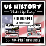 Be ready for the school year with this massive bundle of US History resources, AND SAVE LOTS OF $$. My smaller "Make Life Easy" Bundles were created to give Social Studies teachers a hand when it comes to lesson planning and instructional preparation. This "Big Bundle" combines all of those resourPrice $59.95Original Price $95.68Save $35.73
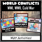 Three Global Conflicts- The Great War (WWI), World War II, and the Cold War, with FIVE different map coloring and labeling activities. Each resource comes with easy-to-follow student directions, follow-up map tasks or questions, and completed sample maps to use as reference. These are very easy fPrice $6.25Original Price $7.50Save $1.25
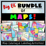 Humans love coloring- tap into your students' interests and apply it to your Social Studies and Geography lessons! 21 different map activities are available and cross many different social studies topics- like American History or Ancient Civilizations. All maps are completely student-centered andPrice $27.99Original Price $37.89Save $9.90
Description
This World War II Map Activity includes two map activities that include blank maps, student direction sheets, follow-up map tasks, and completed sample maps to use as reference. One map activity focuses on Axis Expansion in EUROPE and one on Axis Expansion in ASIA (The Pacific). They can be used with many different age groups, learning styles, and independently- great addition to your WWII unit!
**Note: These maps focus on the peak of Axis power/control during WWII. Please see the completed maps in the preview so that you understand the period of WWII that these particular activities focus on.
Included:
- 2 Blank Maps, Labeled (one Europe, one Asia/Pacific)
- 2 Blank Maps, Not Labeled (one Europe, one Asia/Pacific without countries/waterways labeled)
- 2 Map Directions (with suggested colors to use)
- 2 sets of follow-up, map-reading tasks
- Completed maps for each activity to use as reference or as an answer key.
- Google compatible resource (though blank maps should be printed).
**Please give feedback (and you will earn TpT $$!), and ‘Follow Me’ so that you are the first to get updates and new products!
Check out these other MAP Resources!
