2,732 results
Geography resources on sale
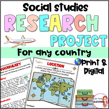
Social Studies Research Project for any Country - Culture and Geography Digital
Social Studies research project for any country / Geography research projectEngage your students in an exciting social studies research project that explores the rich cultural heritage and geography of different countries. This country research project encourages students to explore fascinating topics such as history, traditions, and customs. Through this hands-on geography investigation, students develop a deeper understanding of global diversity and enhance their research and critical thinkin
Subjects:
Grades:
2nd - 6th
Types:
Also included in: Social Studies research project for any country in Spanish - landforms
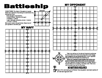
Latitude and Longitude Battleship Game
Here is an engaging game to reinforce your students understanding of latitude and longitude . This is a geography activity your students will enjoy. The directions are included right on the template, so this is a no prep activity that comes ready to play. Watch the kiddos play their way to understanding this important concept. If you would like to get updates on my monthly sale, follow me by pressing the star located just under my name. Looking for more resources for latitude and longitude?Try
Grades:
5th - 10th
Types:
Also included in: Latitude Longitude- States-USA Games Bundle- Collection of 4
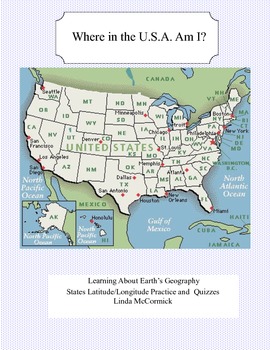
Latitude and Longitude Worksheets and Quizzes - U.S.A. Geography
This collection of worksheets and a printable map provide excellent lessons for learning latitude and longitude. • This package contains 9 pages. • A printable map with the necessary information to answer the questions regarding latitude and longitude.• Includes practice and two quizzes in the “Where Am I” format•Answer KeyThis lesson is google classroom ready.Please e-mail me with any questions about this resource or suggestions for future resources at: ljmccormick33@yahoo.com. If you are diss
Subjects:
Grades:
5th - 9th
Types:
Also included in: U.S.A. Geography- Bundle
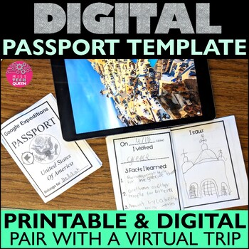
Virtual Field Trip Passport Template Printable Google Classroom Activities World
Engage your students and allow them to "visit the world" with this printable or digital passport! This passport can be paired with Google Earth or Maps to help guide your students through their virtual travels. It's the perfect way to include technology into any geography or cultural lesson.⭐ This is part of the DIGITAL Project bundle. Click here to view all of the items available for Google EDU.How to Use This Passport:Use Google Maps, Earth or show YouTube Videos for virtual traveling multicul
Subjects:
Grades:
2nd - 5th
Types:
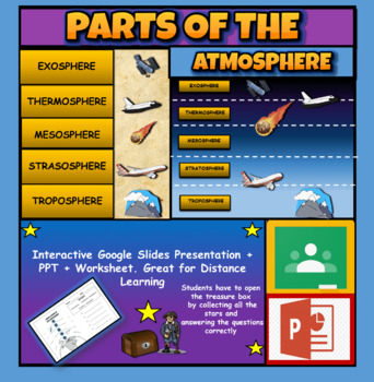
Layers Of The Atmosphere: Interactive Google Slides + PPT Version + Worksheet
Layers Of The Atmosphere: Interactive Google Slides + PPT + Worksheet (Distance Learning)Interactive presentation & quiz on Layers of the atmosphere. Please view the powerpoint previewINTERACTIVE GOOGLE SLIDES/POWER POINT PRESENTATION on layers of the atmosphere. It can be used for distance learning and google classroom or within the classroom.Once downloaded: Please view the GOOGLE SLIDES/POWERPOINT IN 'PRESENT ▶️' modeWorksheet also included in ZIP file 'Parts of the atmosphere' .These are
Subjects:
Grades:
3rd - 8th
Map Skills Book
Discover the world of map skills with this engaging book for students! This comprehensive resource covers essential topics such as the globe, map symbols, cardinal directions, United States map, classroom maps, home maps, and community maps. Dive into the exciting world of geography and navigation with this informative and enjoyable booklet.Check out some of my other ResourcesPumpkin DayTurkey DayHalloween Word ProblemsFollow meFacebookKathryn Loves Teaching BlogTeachers Pay TeachersThank you fo
Subjects:
Grades:
PreK - 2nd
Types:
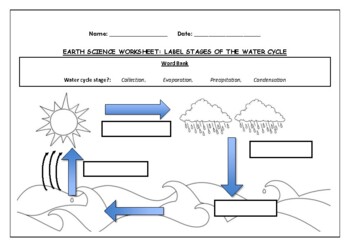
Earth Science worksheet: Label stages of the water cycle
Earth Science worksheet: Label stages of the water cycle2 VERSIONS OF WORKSHEET (Worksheet with a word bank & Worksheet with no word bank)Students have to label the stages of water cycle by looking at the diagram (Evaporation, Collection, Precipitation and Condensation)Students can color in the pictures they are doneWorksheet aimed at higher kindergarten/lower primary levelAnswer Key includedBoth PDF and Editable Word Versions included within the ZIP file
Subjects:
Grades:
K - 6th
Types:
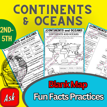
Continents And Oceans | Maps & Globes 7 Continets & Oceans | Facts Activities
Learning about continents and oceans on a map is a great way to engage students and help them remember all seven continents and major oceans in geography. This resource provides tons of practice on maps to help your kids identify the continents and oceans, as well as learn fun new information about each continent and ocean.The facts about continents and oceans are designed in different interactive formats to help your kids engage and have fun while completing them.As there are many questions reg
Subjects:
Grades:
2nd - 5th
Types:
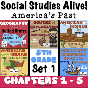
5th Grade Social Studies Alive! America's Past - Chapters 1 - 5 - Set 1
**SAVE BIG BUYING SETS!** Enclosed you will find the first 5 chapters of 5th Grade Social Studies Alive! America's Past Task Cards. There are 24 multiple choice task cards in each set. Buy now and save BIG! ****************************************************************************************************************Included you will find:Geography of the U.S. Chapter 1 Task Cards - History Alive! TCiAmerican Indians and Their Land Chapter 2 Task Cards - History Alive! TCiAmerican Indian Cul
Subjects:
Grades:
5th
Types:
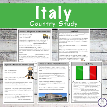
Italy Unit Study
There are so many activities in this study. Primarily fill in the blanks after researching the topics, this pack is great for students in grades 2 - 5.The activities include:*Learning about the Flag*Decorating / colouring in the flag*Mapping places on the map of Italy*Finding Italy on the world map*Learning about the country, population, money and language*Learning about places of interest ~ The Leaning Tower of Pisa, the Roman Colosseum, Milan, Florence, the Trevi Fountain, Naples, Sicily, Tur
Grades:
1st - 4th
Types:
Also included in: Country Research Pack 1
Colonial America Activity for 13 Colonies; 13 Colonies Activities
13 Colonies {New England, Middle, Southern} Scavenger Hunt Activity: A content-rich and fun way to engage students and introduce your unit! ♥You have to see the preview! OVER 600 sold and LOVED!♥This is part of my Colonies BUNDLE {3 Activities!} Let intermediate-middle grade students get up and MOVE while you introduce them to Colonial America!! In this activity, they will complete a scavenger hunt to find important information about the 13 original colonies, the New England, Middle, and Souther
Grades:
4th - 7th
Types:
Also included in: 13 Colonies Activity BUNDLE for Colonial America
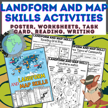
Landform & Map Skills Activity (Poster, Worksheets, Task card, Reading, Writing
Let's spice up your landform and map skills lessons and make learning super fun for your second, third, and fourth-grade students. This Landform & Map Skills Activity (Poster, Worksheets, Task card, Reading, Writing resource covers cool topics like maps, globes, continents, oceans, landforms, suburban, urban, rural areas, directions, and more!The best part? You can use these map skills and landform activities during whole group instruction, independent work, or center time. It's all about fl
Grades:
3rd - 5th
Types:
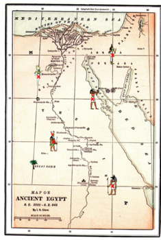
Latitude Longitude Worksheets and an Ancient Egyptian Map -Geography
This resource is a two worksheet lesson on latitude and longitude using a map of Ancient Egypt. It provides map reading practice as well as background information on Ancient Egypt. There is a Key provided. Good geography practice for all middle school students.This lesson is google classroom ready.Please e-mail me with any questions about this resource or suggestions for future resources at: ljmccormick33@yahoo.com. If you are dissatisfied in any way, please contact me right away by email or
Grades:
5th - 9th
Types:
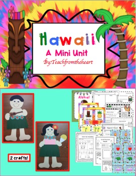
Hawaii ( A Mini Unit)
Aloha! I created this mini unit all about Hawaii for my kiddies! With so much culture and attractions, your students will feel like they just took a mini vacation! :) I have also included boarding passes to give out when you begin the unit! This is great to go with any social studies unit, too. I have also included a MINI BOOK! :)
Here's what is included:
-Hawaiian boy and girl craft (with guitar and shaved ice!) :)
-Boarding pass for girl and boy(I give these out before the unit begins)
-Aloh
Grades:
1st - 4th
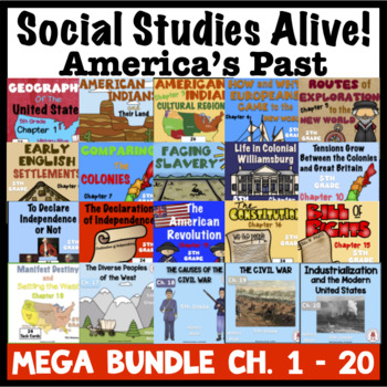
5th Grade Social Studies Alive MEGA Bundle Ch. 1 - 20
**SAVE BIG BUYING BUNDLES** Enclosed you will find ALL the chapters of 5th Grade Social Studies Alive! America's Past Task Cards, chapters 1 - 20. There are 24 multiple choice task cards in each set. Buy now and save BIG! ***************************************************************************************Be sure to check the preview on each of these chapters to see what you are getting.This MEGA BUNDLE is also part of the 5th Grade Social Studies - America's Past Sets 1 - 4.Please be sure
Subjects:
Grades:
5th - 8th
Types:
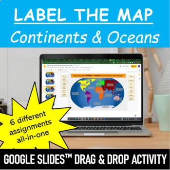
Label the Map - Continents and Oceans | Google Slides™ Drag & Drop Activity
Let your students have fun labeling Earth’s 7 continents and 5 oceans with this interactive mapping Google Slides™ Drag & Drop Activity. The digital resource comes with 6 different assignments all-in-one, as well as two different color schemes. The activity is designed for Google Classroom users, but can ALSO be downloaded, printed and used as a handout in the classroom. Pick and choose what best serves your classroom. Click HERE if you want a cut and paste version of the same activity with
Subjects:
Grades:
Not Grade Specific
Types:
Map Skills - Performance Tasks
Maps performance tasks! Here are two performance tasks that I created and used with my first grade students when we completed our unit. We actually did a practice run creating a map of our classroom early in the unit so they had experience doing something very similar to this. Updated with new BW graphics and fonts. Students get to name their own farm and playground to create the maps. They really did a great job with these and most were easily able to show Proficiency. For each map, I gave t
Subjects:
Grades:
1st - 2nd
Types:
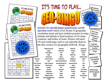
Latitude and Longitude GeoBingo - World Geography Game
Includes 32 colorful bingo gameboards and 80 question cards which cover dozens of geography vocabulary terms and give students practice in using latitude and latitude to find locations of US states, countries, and bodies of water. Players will need US and world maps such as one typically finds in the atlas section of a geography textbook. 40 pgs.Please e-mail me with any questions about this resource or suggestions for future resources at: ljmccormick33@yahoo.com. If you are dissatisfied in any
Subjects:
Grades:
5th - 10th
Types:
Also included in: Latitude Longitude- States-USA Games Bundle- Collection of 4
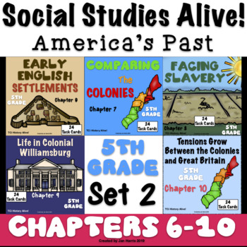
5th Grade Social Studies Alive! America's Past - Chapters 6 - 10 - Set 2
**SAVE BIG BUYING SETS!** Enclosed you will find chapters 6 through 10 of 5th Grade Social Studies Alive! America's Past Task Cards. There are 24 multiple choice task cards in each set. Buy now and save BIG!****************************************************************************************************************Included you will find:Early English Settlements Chapter 6 Task Cards History Alive! TCiComparing The Colonies Chapter 7 Task Cards History Alive! TCiFacing Slavery Chapter 8 Task
Subjects:
Grades:
5th
Types:
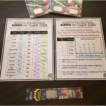
SOLAR ECLIPSE (MATH, SCIENCE, SS)
Are you looking for a fun activity way to teach about solar eclipses?! This will be perfect for you! This activity integrates Social Studies, Science, and MATH!August 2017 ECLIPSE MAGNITUDES: Across the United States- Students look at a map and determine the states of each city listed on the table.- Next, they convert each percent (magnitude) to a fraction.- Then they simplify the fractions to lowest terms.- Finally the students create a line plot using the percent data and answer questions!I al
Subjects:
Grades:
4th - 6th
Types:
4th Grade Social Studies Alive! Regions of Our Country - Chapters 1 - 5 Set 1
**SAVE BIG BUYING SETS!** Enclosed you will find the first 5 chapters of 4th Grade Social Studies Alive! Region's of Our Country Task Cards. There are 24 multiple choice task cards in each set. Buy now and save BIG!****************************************************************************************************************Included you will find:Discovering the Social Sciences Ch. 1 Task Cards History Alive!Exploring Regions of the U.S, Chapter 2 Task Cards - History Alive!The Peopling of the
Grades:
4th
Types:
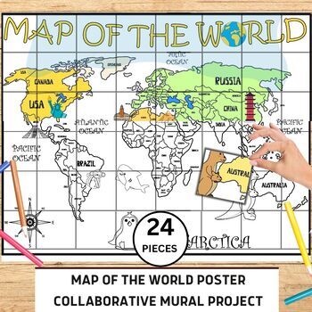
World Map Collaborative Poster Mural Project - Geography Unit , Classroom Decor
⭐️⭐️World Map Mural Collaborative Project Poster⭐️⭐️Transform your classroom with the Collaborative World Map Mural, a captivating and educational poster set. Consisting of 24 6x7 inch square pieces, students can contribute to this engaging bulletin board project. The mural promotes teamwork, critical thinking, and geographical awareness as students research and add drawings, facts, and experiences to represent different regions, countries, and landmarks. This visually stunning display fosters a
Grades:
1st - 4th
Also included in: 21 Collaboration Posters Mural Project - Classroom Decor ,Craft, BUNDLE
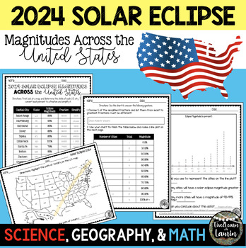
2024 SOLAR ECLIPSE MAGNITUDES ACROSS UNITED STATES - STATE CAPITALS
Are you looking for a fun activity on Solar Eclipse Day that is not busy work? This Solar Eclipse Activity integrates Science, Geography and MATH! Students handle REAL and RAW DATA about the magnitudes (for the April 8, 2024) for each state capital across the United States all while ... converting percents to fractionssimplifying fractionsordering fractionsmaking line plotsanalyzing datausing mapsreviewing state abbreviationsThis is geared towards 4th grade Math standards, but would make great p
Subjects:
Grades:
4th - 8th
Types:
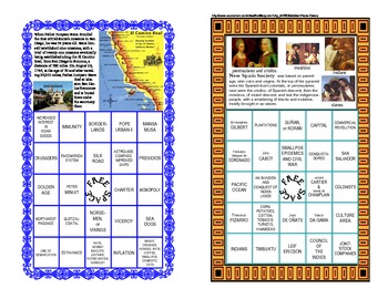
European Explorers Bingo Game - Age of Exploration -Age of Discovery
This artistically designed game is a fun-filled way to give your class a thorough review of European Exploration. This colorful themed Bingo game can be printed on heavy cardstock and laminated to make a lasting reusable game. As an alternative, you can choose to print it on paper and allow the students to cross off the answers. This Bingo Games has 36 unique game cards that contain extra facts and images about the Age of European Exploration. Included are one hundred question cards with ans
Grades:
5th - 9th
Types:
Showing 1-24 of 2,732 results


